

Volume Surveys
WE OFFER HIGHLY ACCURATE AND FAST VOLUMETRIC SURVEYS USING LASER SCANNING TECHNOLOGY
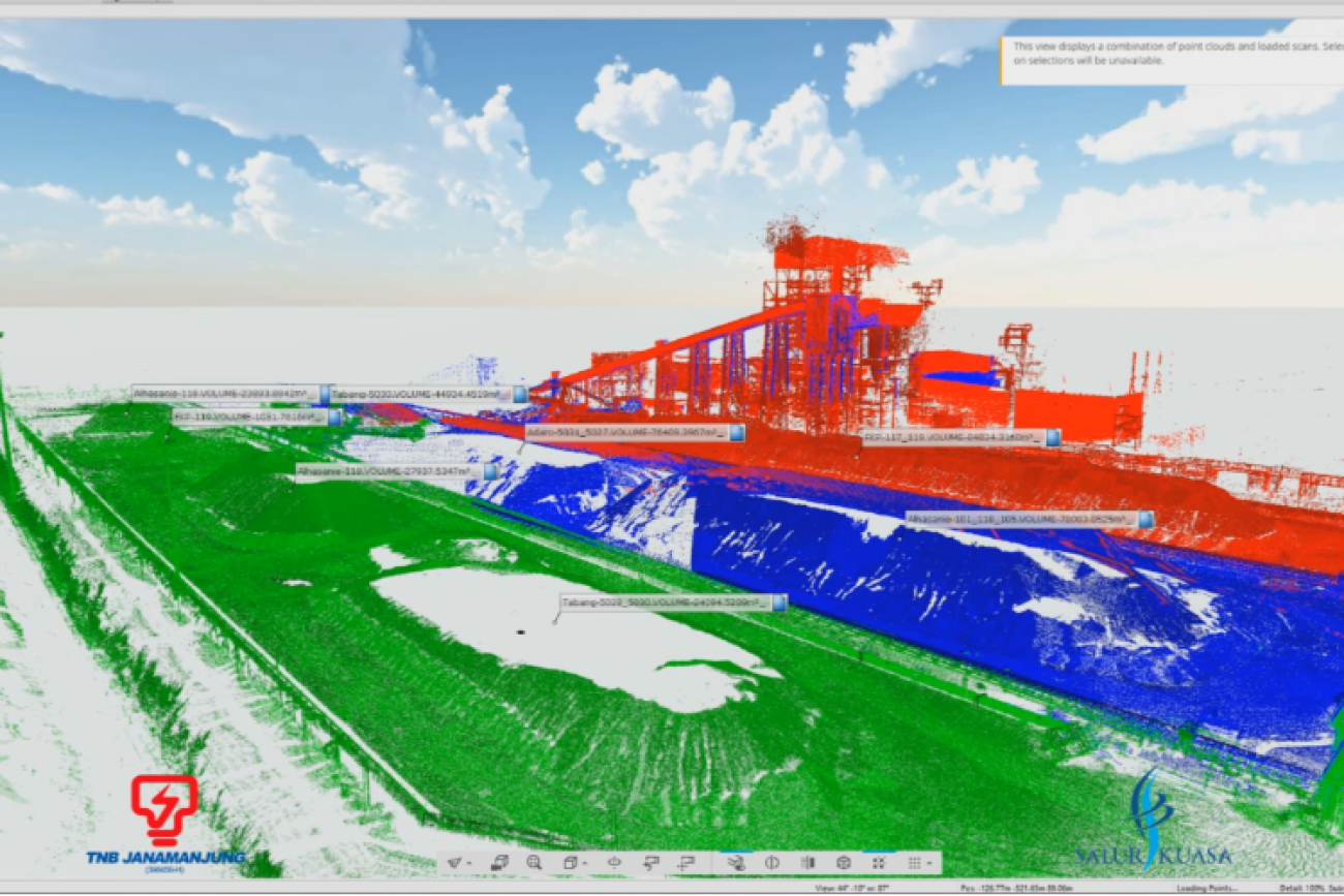
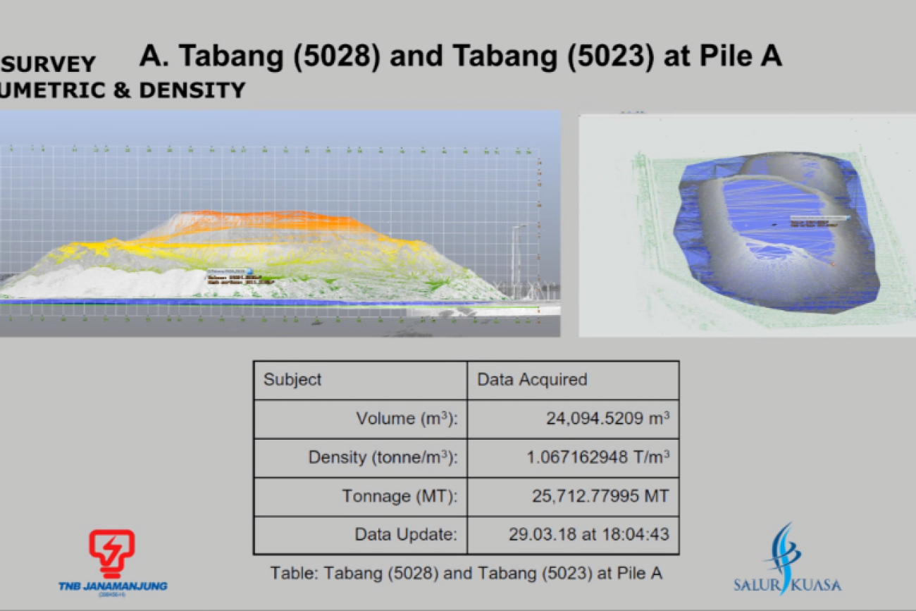
3D laser scanning enables precise volumetric surveys to be completed in record time. Georeferenced point cloud data may be transformed into any coordinate system.
The point cloud mesh models are exceptionally accurate reconstructions of the scanned landscape or chamber. We can calculate volumes relative to any given datum by comparing meshes or meshes to flat surfaces.
ADVANTAGES OF USING 3D LASER SCANNING FOR VOLUME SURVEYS:
Highly detailed representation of measured surfaces – High accuracy
Long range, non-contact data collection
Speed data collection